| Home | About Pakistan | Tourism in Pakistan | Travel Destination | Travel Guide | Fair & Festival | FAQs |
|
Geography
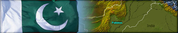
of Pakistan. Pakistan is located in South Asia. To the south is the Arabian Sea, with 1,046 km of Pakistani coastline. To Pakistan's east is India, which has a 2,912 km border with Pakistan. To its west is Iran, which has a 909 km border with Pakistan. To Pakistan's northwest lies Afghanistan, with a shared border of 2,430 km. China is towards the northeast and has a 523 km border with Pakistan.
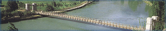
The main waterway of Pakistan is the Indus River that begins in China, and runs nearly the entire length of Pakistan, flowing through all of Pakistan's provinces except Balochistan. is fed by the combined waters of three of the five rivers of Punjab the Chenab, Jhelum, and Ravi. The waters of the other two rivers, the Beas and the Sutlej, are largely withdrawn for irrigation in India. Along the Indus and its tributaries are found most of Pakistan's population, its chief agricultural areas, and its major hydroelectric power stations, interconnected by the world's largest system of agricultural canals, join the Indus before it discharges into the Arabian Sea.
The northern and western areas of Pakistan are mountainous.
Pakistani administered areas of Kashmir contain some of the highest
mountains in the world, including the second tallest, K-2. Northern
Pakistan tends to receive more rainfall than the southern parts
of the country, and has some areas of preserved moist temperate
forest. In the southeast, Pakistan's border with India passes through
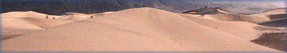
a flat desert, called the Cholistan or Thal Desert. West-central
Balochistan has a high desert plateau, bordered by low mountain
ranges. Most of the Punjab, and parts of Sindh, are fertile plains
where agriculture is of great importance. Agro Ecological zones
include: |
| Important Links | Link Partners | Contact us |